Mountain Country WA Mount Barker Logo Mountain Country WA Mount Barker Logo
    • Popular searches
    • Accommodation
    • Restaurants, Cafes & Bars
    • Retail
    • Wineries
    • Services
    • Community Organisation
    • Art
    • Explore
      • Towns
        • Mount Barker
        • Kendenup – Small towns great views
        • Narrikup
        • Porongurup
        • Rocky Gully
      • Parks & Reserves
        • Mondurup Reserve
        • Mount Lindesay National Park
        • Porongurup National Park
        • Stirling Range National Park
        • Twin Creeks Conservation Reserve
      • Local Favourites
    • Eat, Drink & Stay
      • Accommodation
      • Art
      • Community Organisations
      • Eat & Drink
      • Retail
      • Services
      • Tours & Experiences
      • Wineries
    • About Us
      • Mountain Country Tourism
      • Mount Barker Visitor Centre
      • Directory Subscription
    Join Directory
    Sign in or Register
    Join Directory

    Toolbrunup Peak

    The second highest peak in the Stirling Range

    • Trail
    • prev
    • next
    • Share
    • Website
    • Google Maps
    • prev
    • next
    Description

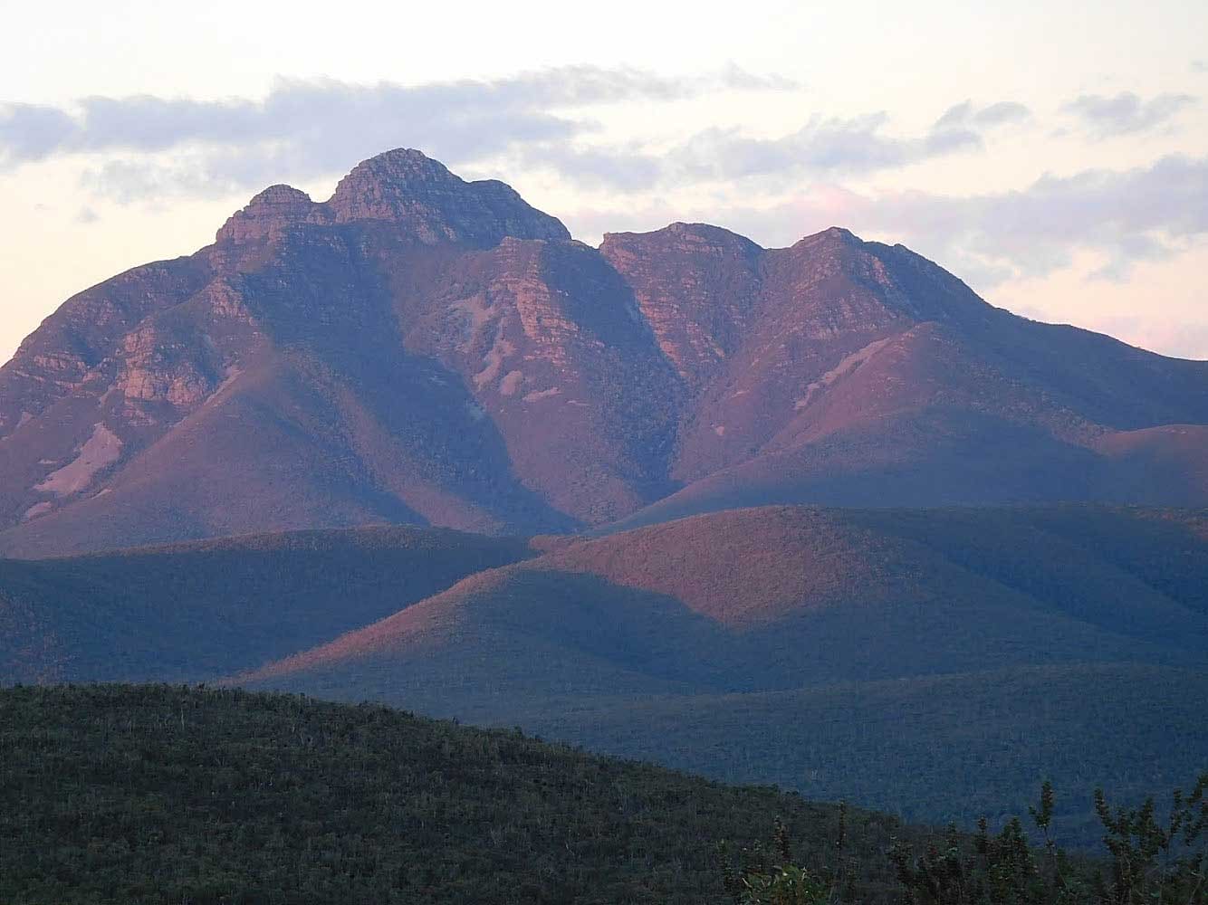
    Enjoy magnificent views from the summit of Mt Toolbrunup, the second highest peak in the Stirling Range.  A good degree of fitness is required for this four kilometre return hike.

    4 kilometres return – difficulty hard – 3 to 4 hours return. Approximate elevation: 1052m. A popular hike which entails some loose rock, scrambling conditions in places and is considered steep and challenging for the average person, requiring fitness and agility. It is recommended to follow the marker posts and not to stray on side tracks.

    The trail leaves the carpark and leads through woodland, mostly following the bank of a creek and becoming progressively steeper. Beyond the woodland it rises steeply over large boulders, loose rocks and steep scree to a saddle near the top of the south-west buttress. From here it’s a short, steep scramble to the top. During spring, those who reach the upper slopes will be rewarded with beautiful mountain bells and southern cross flowers.  For more information visit TrailsWA.

    Details
    • Title
      Toolbrunup Peak
    • Difficulty level
      Hard
    • Distance
      4km
    • Approximate elevation
      1052m
    • Duration
      3 - 4 hours
    Gallery
    Toolbrunup Peak, photo credit: Mike Thorn
    National Park
    • Stirling Range National Park

    You May Also Be Interested In

    Talyuberlup

    Offers the unique experience of looking through a hole in the mountain.
    Stirling Range National Park
    • Hikes

    Mount Trio

    The trail starts and finishes at a picnic area set amongst shady trees
    Stirling Range National Park
    • Hikes

    Mount Hassel

    Offers excellent views
    Stirling Range National Park
    • Hikes
    About
    • Visitor Centre
    • Mountain Country Tourism
    • Events
    • Terms & Conditions
    • Contact

    Explore

    • Accommodation
    • Art Galleries
    • Attractions
    • Eat & Drink
    • Retail
    • Services
    • Walks & Trails
    • Wineries

    Towns

    • Mount Barker
    • Kendenup
    • Narrikup
    • Porongurup
    • Rocky Gully

    Parks & Reserves

    • Mondurup Reserve
    • Mount Lindesay
    • Porongurup
    • Stirling Range
    • Twin Creeks
    Member Area
    • My Account

    FOLLOW US

    Facebook-f Instagram
    Mount Barker Great Southern Wine

    Supported by

    shire of plantagenet
    Made with ❤ by Web Mojo

    Cart

      • Popular searches
      • Accommodation
      • Restaurants, Cafes & Bars
      • Retail
      • Wineries
      • Services
      • Community Organisation
      • Art
      • Facebook
      • Twitter
      • WhatsApp
      • Telegram
      • Pinterest
      • LinkedIn
      • Tumblr
      • VKontakte
      • Mail
      • Copy link