- Share
- Website
- Google Maps
- prev
- next
Description
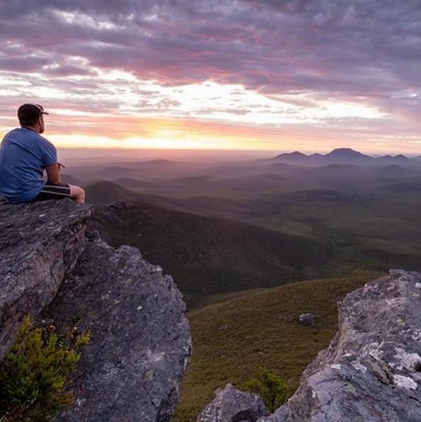
6 kilometres return – difficulty medium if taken slowly – 3 to 4 hours return. Approximate elevation: 1094m. Certainly the most popular walk. Trail is well marked. Breath taking 360 degree summit views.
Please take:
Minimum 2 litres of water per person per day
Sturdy shoes
Sun hat or bike helmet (compulsory in WA)
Sunglasses, sunscreen (30+) and insect repellant
Binoculars and camera (optional)
Map or guide book where suggested
Snacks and/or lunch depending on length of trail
Clothes to suit the activity and potential weather conditions including a water/windproof jacket
First Aid kit
Walks in the Stirlings
Preparation and Survival – The walks are of varying grades, the weather can change quickly and park passes are required. Make sure you assess the walks and pace yourself in accordance with your fitness and health, wear and take appropriate clothing, footwear and sunscreen, don’t overload yourself and take plenty of water. Please DO NOT rely on mobile phones for communication as coverage is scarce at best in this area.
Long Treks – Sadly, there have been fatalities and resource expensive recoveries. Anyone considering long ridge treks MUST therefore, undertake suitable preparation and appropriate precautions. Please consult with and notify the Stirling Range National Park rangers or the Albany District Office to obtain more detailed information. (Stirling Range National Park office – 9827 9230; Albany District office – 9842 4500). If you are planning to hike off marked trails, abseil or rock climb, please register your details at the shelter in the picnic area across the road from Bluff Knoll Road entry station. If you plan to hike on an established walk, no registration is required. It is recommended that you equip yourself with an EPIRB or Personal Location Beacon(PLB).
Details
-
TitleBluff Knoll
-
Difficulty levelMedium
-
Distance6km return
-
Approximate elevation1094m
-
Duration3 - 4 hours
Gallery